

3:2
Port guide platform
Two hundred and twelve ports catalogued, and a day ashore you can plan in five minutes.
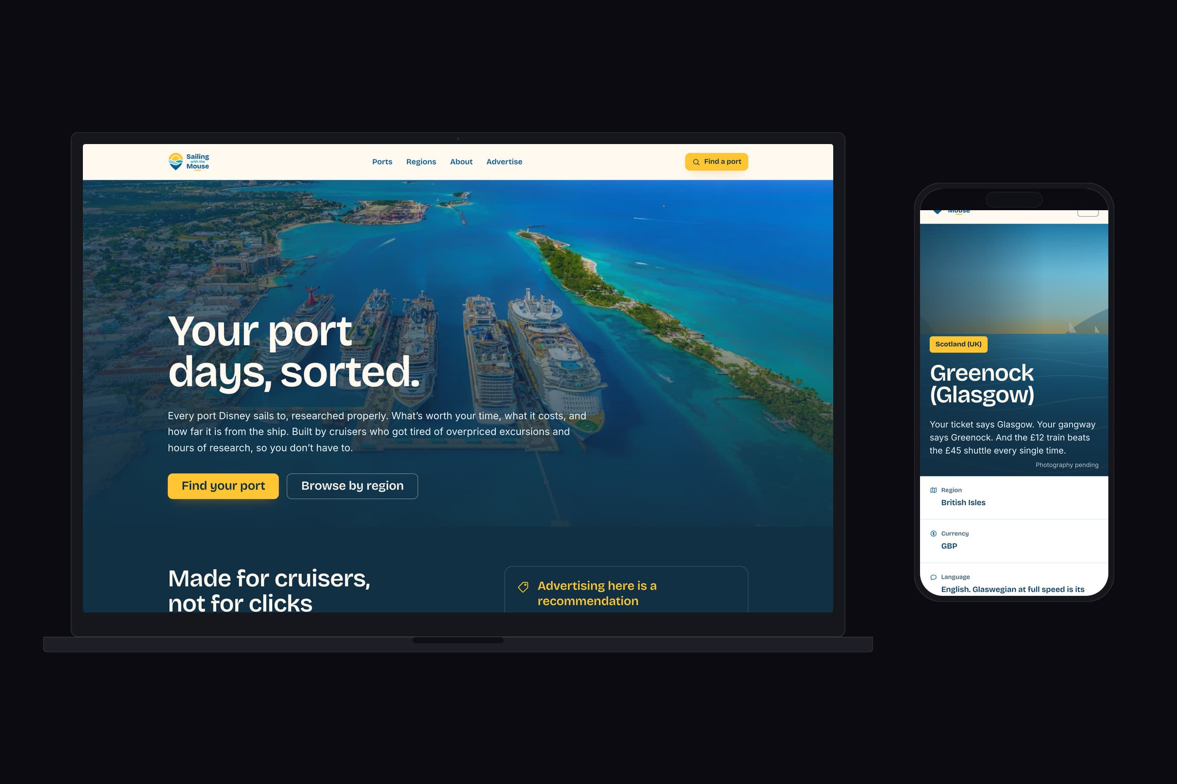
Port days, sorted1/5
The brief
A cruise passenger gets one day in a port and very little to go on. The search results are affiliate lists that rank on commission, the official excursions are priced accordingly, and the honest answer to what is worth doing is buried in a forum thread from four years ago. The brief was a reference site that a cruiser would actually trust, covering every port the line calls at, and earning that trust by being useful rather than by shouting.
Treat it as a database with an opinion rather than a blog. Every place is researched against the two questions a passenger actually asks on the morning, how far is it from the ship and what will it cost me, and the whole site is built to answer those two first. Everything else follows from getting the structure right.
What we made
Distance and price are the spine, not the footnotes.
Most travel content buries the practical detail under the prose. Here it is the schema. Every entry carries its walking time from the berth and its price per person, so the site can sort and filter on both, and a reader can set a budget and watch every list on the page re-rank around it. Nothing is hidden when it does not fit, it just moves down. That one decision is what makes 212 ports navigable rather than merely present.
Two hundred and twelve ports, twenty-four written.
The index lists every port the line calls at, including the ones with no guide yet, and says so plainly. It would have been easier to list only the finished ones and look complete. Showing the whole map with the gaps marked is more useful to a cruiser checking whether their itinerary is covered, and it is the more honest thing to put in front of someone deciding whether to rely on you.
Built to be read at the rail.
The desk is where the planning happens and the gangway is where the guide gets used, usually one handed, often on ship wifi. The port pages carry their own section navigation so a reader lands where they need to be rather than scrolling for it, and the map plots everything against the berth so distance is read rather than guessed.
Made for cruisers, not for clicks.
The positioning is stated on the homepage and then kept to. No commission-ranked lists, no padded copy written for a search engine, and nothing published that has not been checked. It costs traffic in the short run and it is the only version of this site worth building, because the entire proposition is that a stranger's recommendation can be relied on.
Detail
Delivered
- Content model and site architecture
- Design system and page templates
- Port and region guide templates
- Budget and distance filtering
- Mapping and search
- Build, hosting and deployment
Outcome
A reference site that answers the two questions a cruiser actually has, before the ship docks.